Professional Bathymetric Surveys
Accurate water depth mapping and underwater feature detection for navigation, dredging, and marine projects.
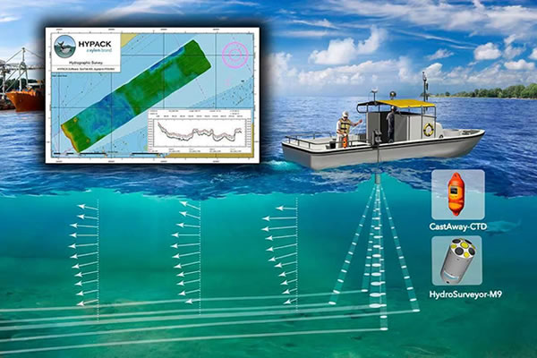
At Olaf Geo Services Ltd, we provide high-quality bathymetric survey services using advanced echo-sounders, GPS, and GIS technologies. Our surveys deliver accurate data on water depths, seabed profiles, and underwater conditions to support engineering, construction, environmental studies, and safe navigation.
Hydrographic & Depth Sounding
Seabed & Riverbed Profiling
Dredging Volume Calculations
Harbor & Port Development Support
Bridge & Marine Structure Surveys
GIS Integration & Mapping
Our bathymetric survey reports are precise, reliable, and presented in formats suitable for engineers, planners, and marine authorities.